Feedback from shooting with the Mavic 3M
After a few weeks’ use, I’d like to give you my first impressions of using the DJI Mavic 3M to shoot field trials.
The drone
The drone is compact, and easy to transport with its batteries and accessories in its sturdy little case. Although the autonomy of each battery is very good, a total of 4 charged batteries offers good security for missions.
The remote control
The remote control, with its integrated DJI Pilot 2 software, is easy to use. Even if it sometimes takes a fairy’s fingers to access certain menus! Before setting off on a mission, I check whether the remote control and drone software need updating. Because these updates are quite frequent.
You can create a mapping flight directly in the field. All essential parameters are easily accessible. Ground height in automatic flight is limited to a minimum of 12m with the Mavic 3M, which can be a problem if high definition is required.
I haven’t had the slightest connection problem or loss of link between the remote control and the drone so far, whatever the conditions, even next to a very high-voltage power line. What a change from my old DJI Spark!
The cameras
The integration of RGB (visible spectrum) and multispectral shooting is impeccable, and you can switch from RGB to RGB+MS in just 1 click.
20 Mpixel RGB camera: a photographer’s reflex, I prefer to operate in aperture-priority mode to close the diaphragm and gain in image quality at the edges. A minor disappointment, however, is the lens, which shows considerable distortion and vignetting, with darkening of the corners (see example below). For illustrations, activation of the “dewarp” direct image software correction function is essential, or else the application of a post-shot software correction (Lightroom or other).
For mapping, RGB images are not corrected by default (dewarp off), and the photogrammetry software I tested (DJI Terra and Pix4DFields) handles defects without any apparent problems. But I remain convinced that a better-corrected lens producing a cleaner image would not harm the final rendering. Maybe for the Mavic 4M 🙂
GPS and RTK positioning
The RTK module supplied with the drone works very well. I use the free Centipède RTK network by default https://docs.centipede.fr/ , but appreciate having access to a paid subscription network in situations where the Centipède connection is not stable.
In conclusion
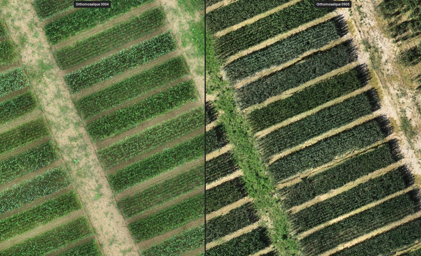
Orthomosaics created from RGB and multispectral images in automatic flights with RTK positioning speak for themselves. The correspondence between 2 shooting dates and between RGB and MS images is perfect in all cases, demonstrating the overall robustness of the system.
Illustrations below
- Orthomosaic correspondence between 2 RGB shooting dates (with cloud cover and full sun)
- Orthomosaic matching between multispectral and RGB
- Orthomosaic definition comparison between multispectral (5 Mpix) and RGB (20 Mpix)


To be continued !